Land Disturbance Products
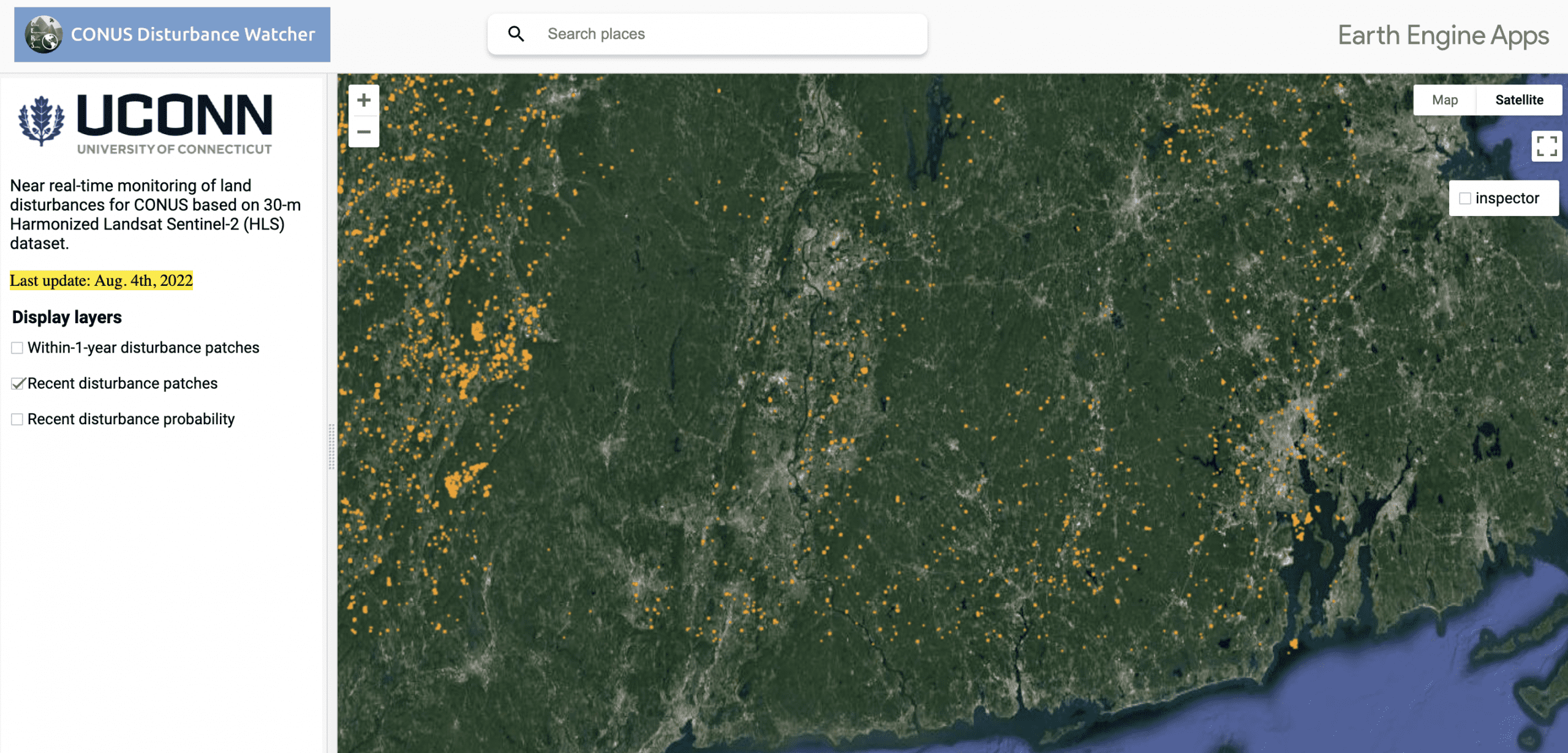
Near-real-time Updated Land Disturbance Maps
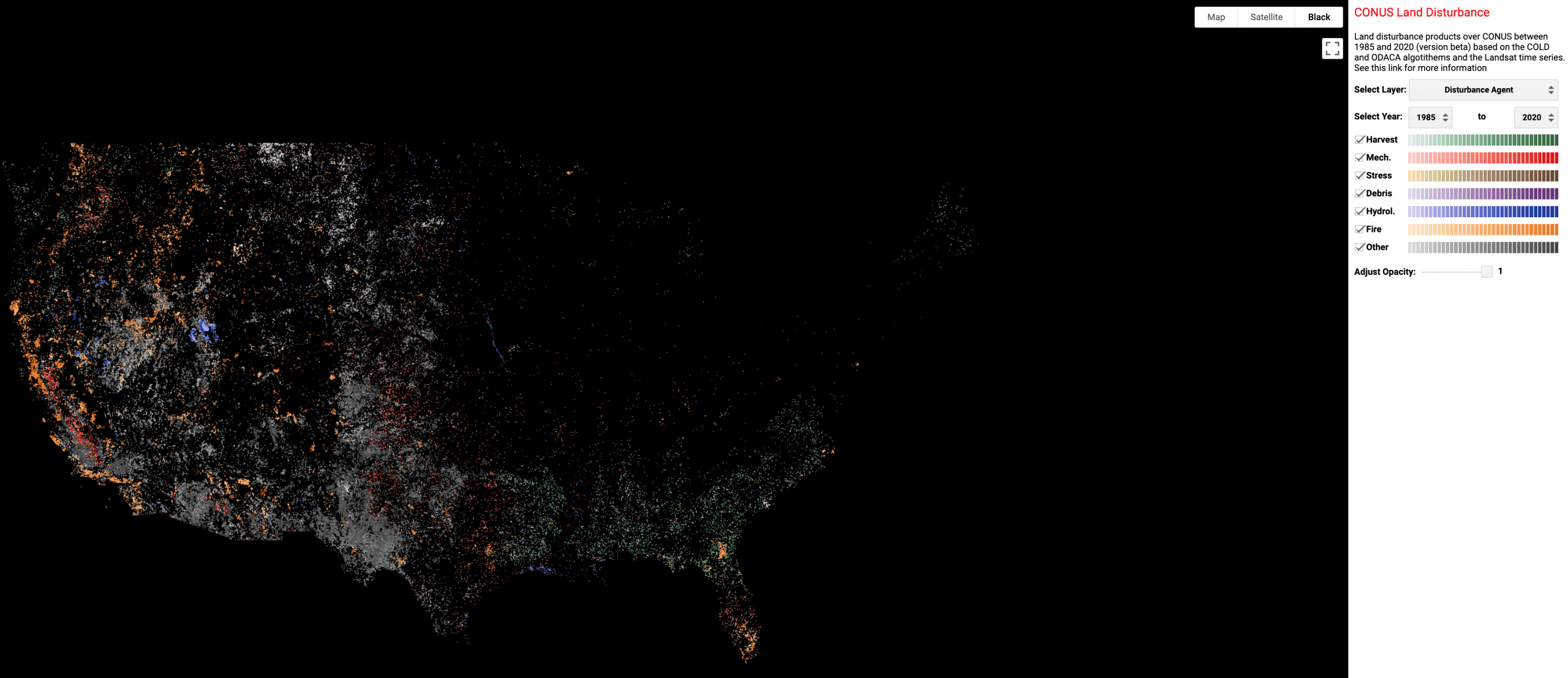
CONUS-wide Land Disturbance Agent Maps from 1985 to 2022
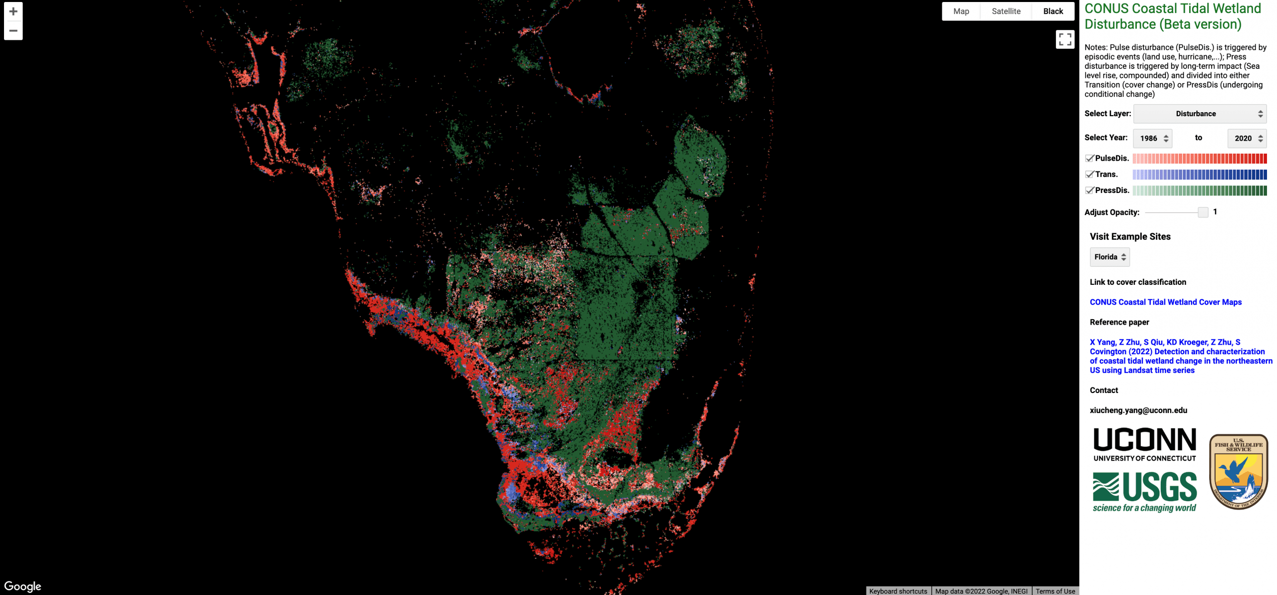
Coastal Tidal Wetland Change Products
CONUS-wide Coastal Tidal Wetland Disturbance Maps from 1986 to 2020
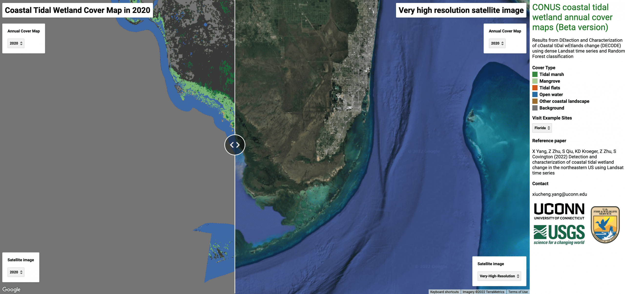
CONUS-wide Coastal Tidal Wetland Cover Maps from 1986 to 2023
Florida Mangrove vulnerability and resilience maps from 2000 to 2022

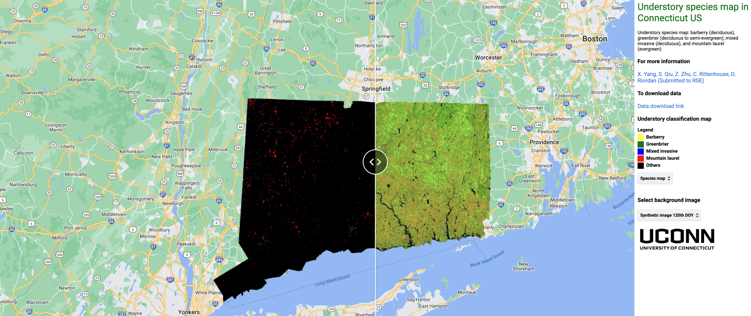
Understory Species Products
Understory species map for CT, USA